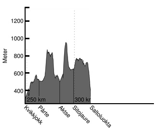
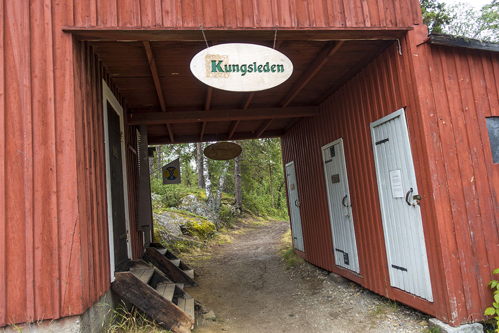
WHERE: Stage 4: Kvikkjokk to Saltoluokta – Kungsleden, Sweden
WHEN: August 18-24, 2016
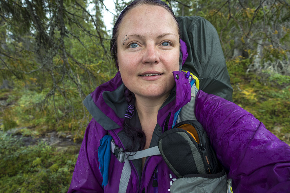
WHO: Karma & Helena
OBJECTIVE: Thru-hike, #rebootatforty
DISTANCE: 83 km (completed: 336 km in total)
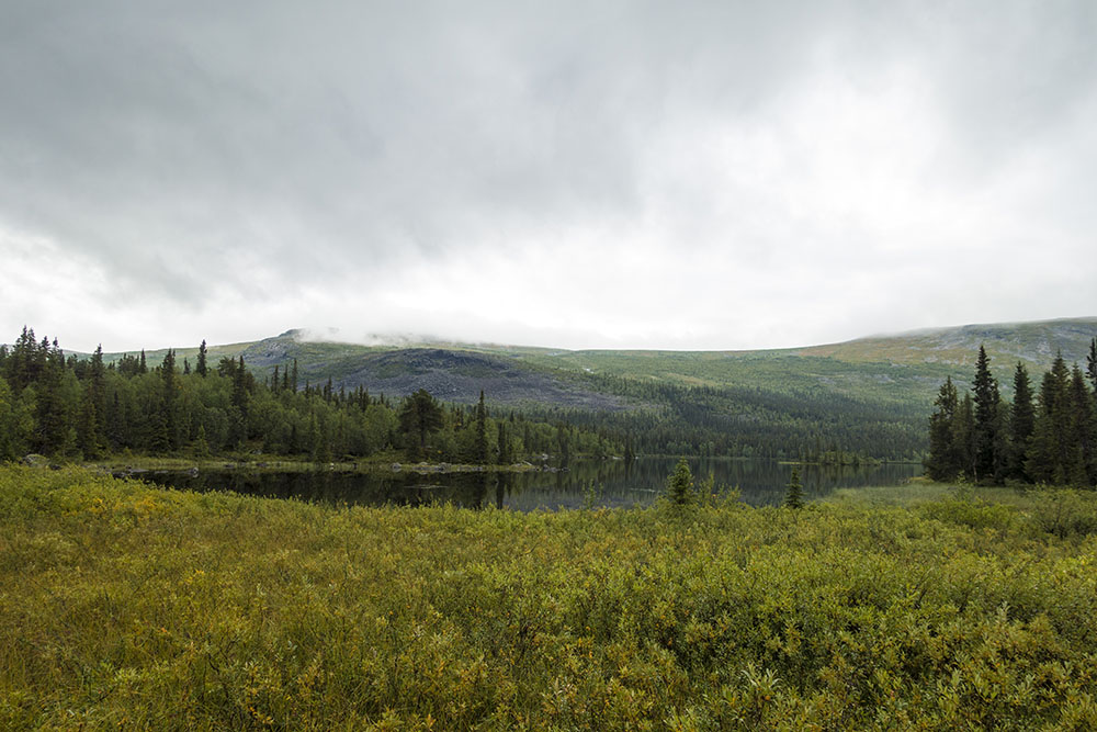
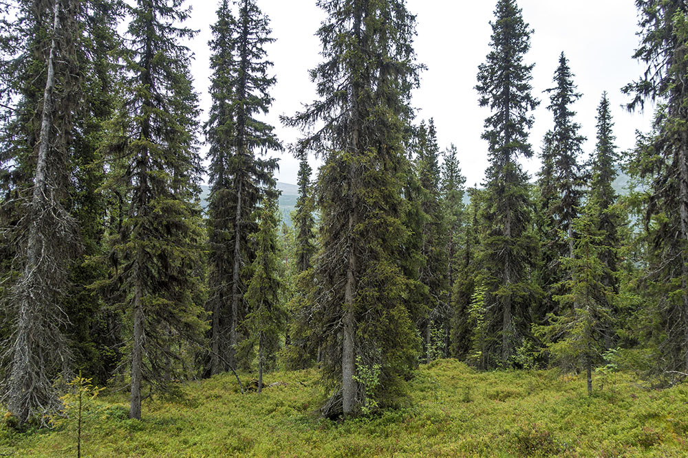
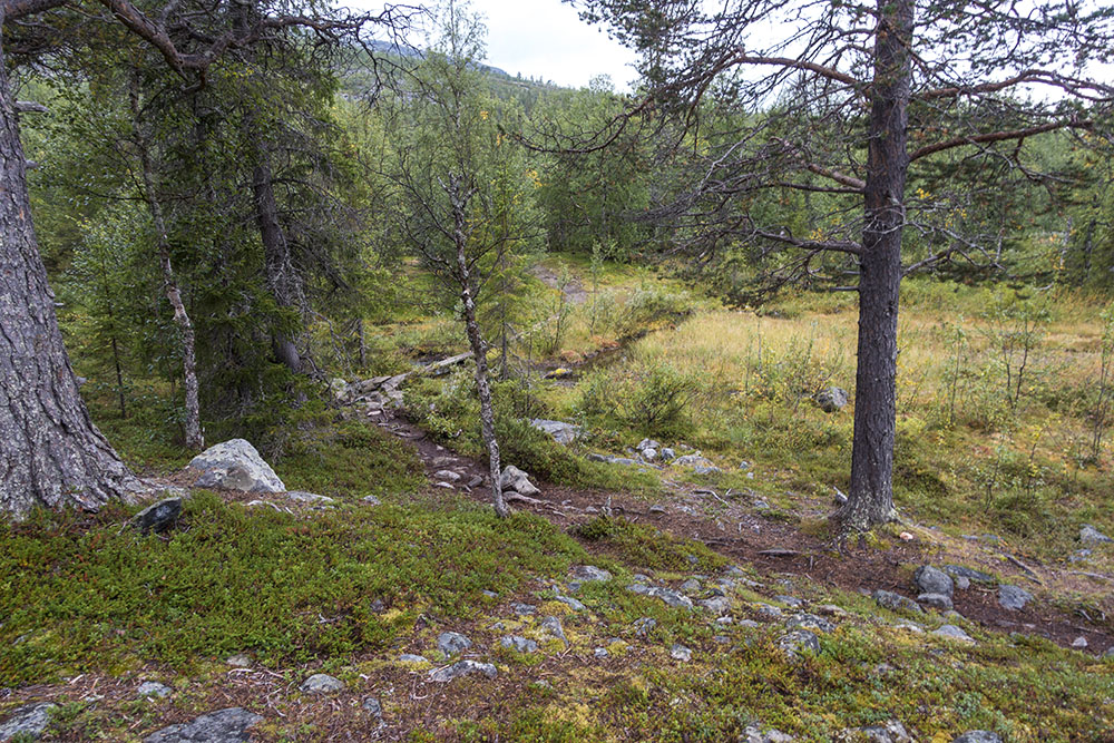
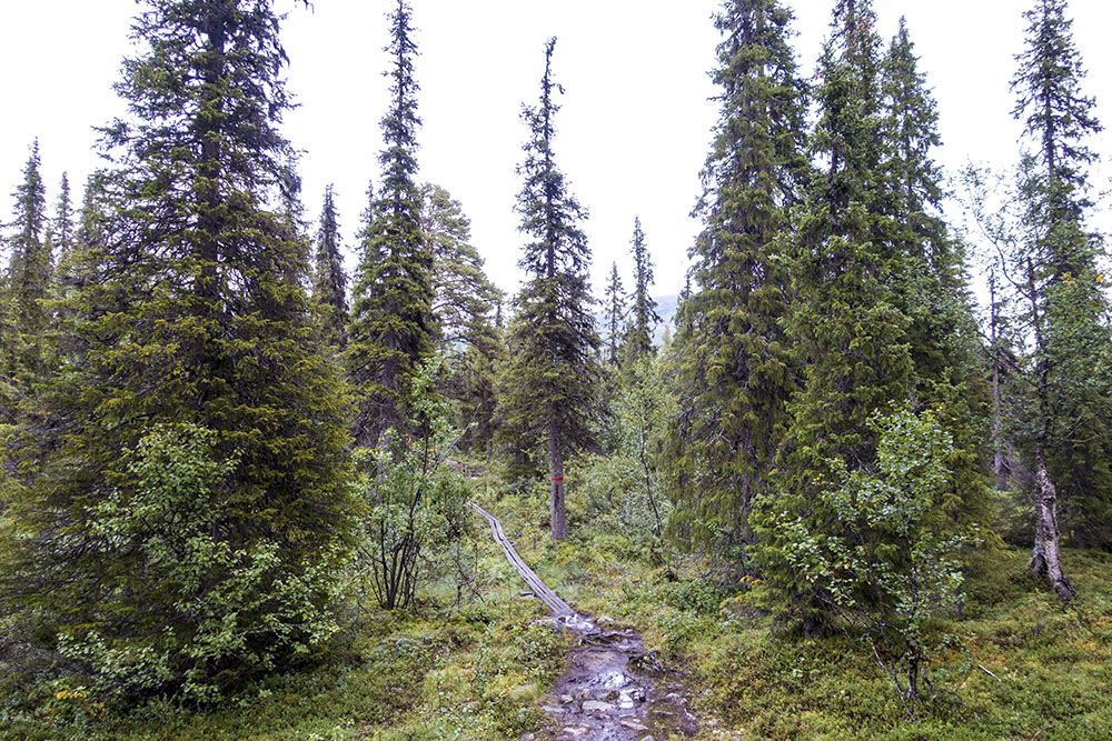
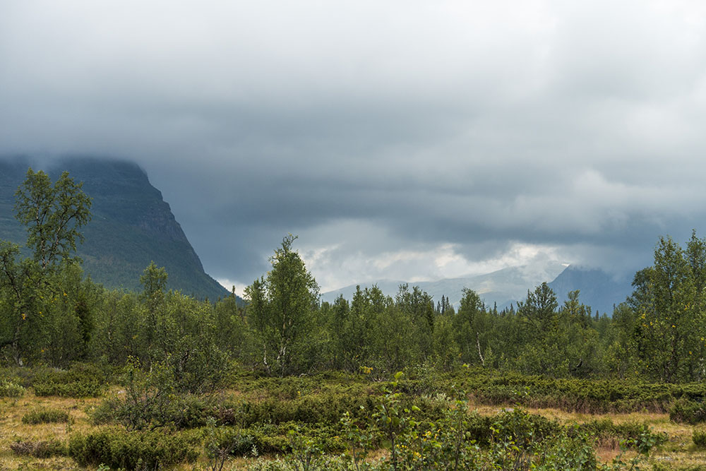
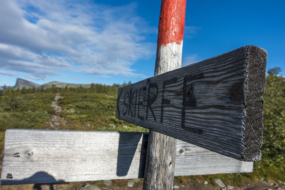
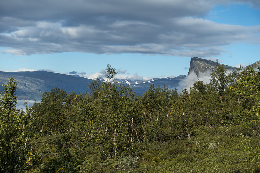
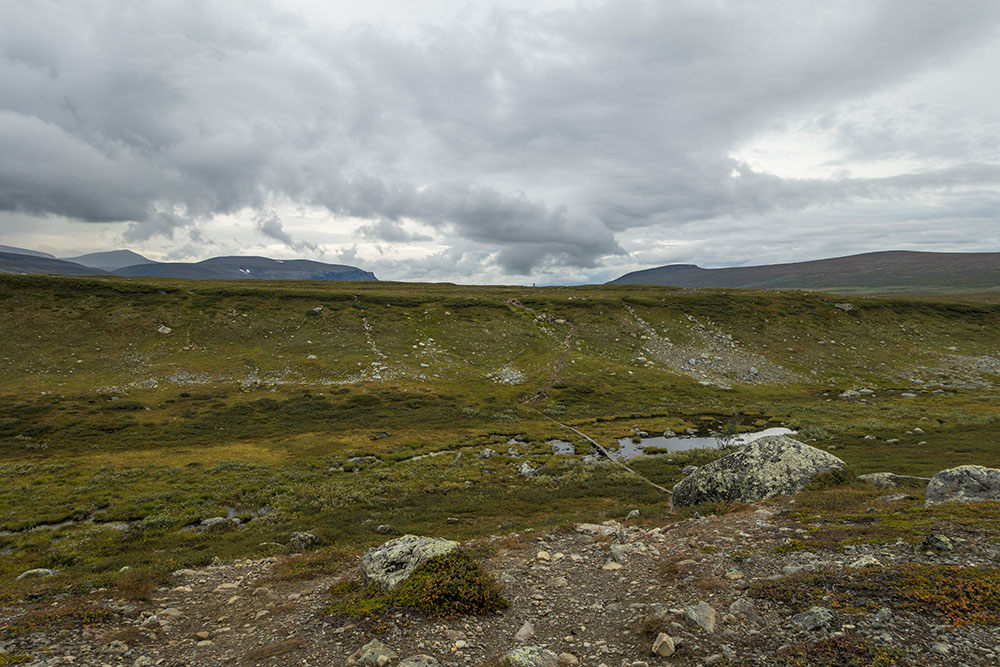
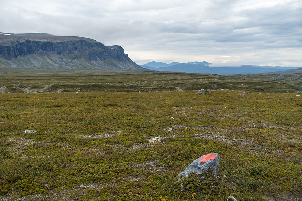
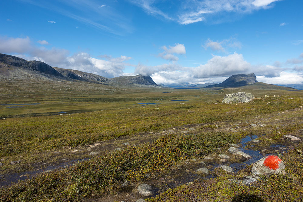
Though the trail mostly cuts through a considerable amount of dense coniferous forests dotted with lakes this stage hugs the border of the high mountain region in Sarek to the east and the open moorlands to the west. The trail was in pretty bad shape, really worn by foot traffic and poorly maintained compared to most sections further south. We also met a lot more people on this stretch. We actually met more people in one day than we had on all the precious stages combined. Mostly ill-prepared tourists not genuine hikers, and that was a little disconcerting and hard getting used to. The combination made for a demanding stage in more ways than one. So aside from an amazing detour up the summit of Skierfe, which was among the top highlights of the entire thru-hike, this was my least favorite stage over all. Mainly due to the monotonous nature of the landscape and the dismal condition of the trail. Though the weather probably played its part as well, yeah another really wet one.
Kungsleden thru-hike + Sarek travel diary
DAY 1
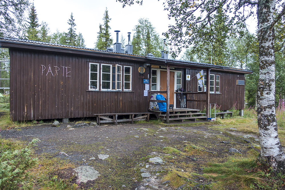
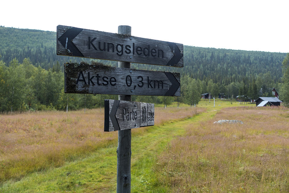
Kvikkjokk – Pårte
Distance: 16 km
Date: 19 August, 2016
STF hut: 67.042943° N, 17.944152° E
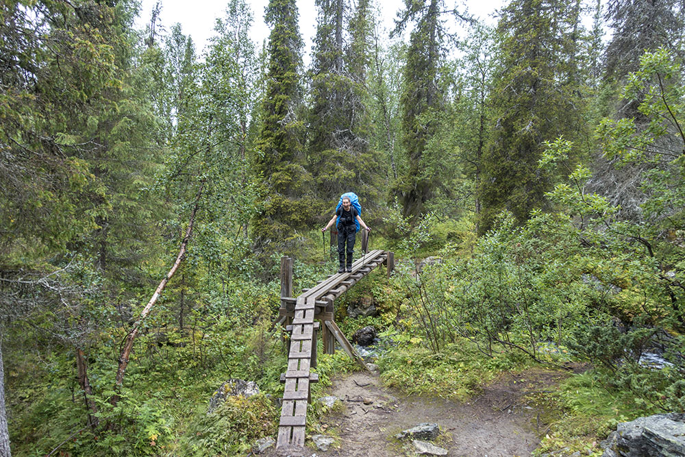
Woke around seven and tried not to wake up the whole room while getting ready. As we were having breakfast in the self-serve kitchen the skies opened so we decided to hold off a little and by the time we hit the trail by 9:30 or so the rain had pretty much stopped. We stayed dry until lunch, after that it was touch and go all day.
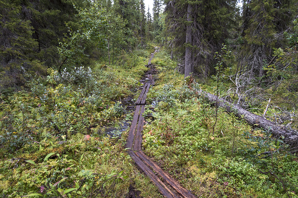
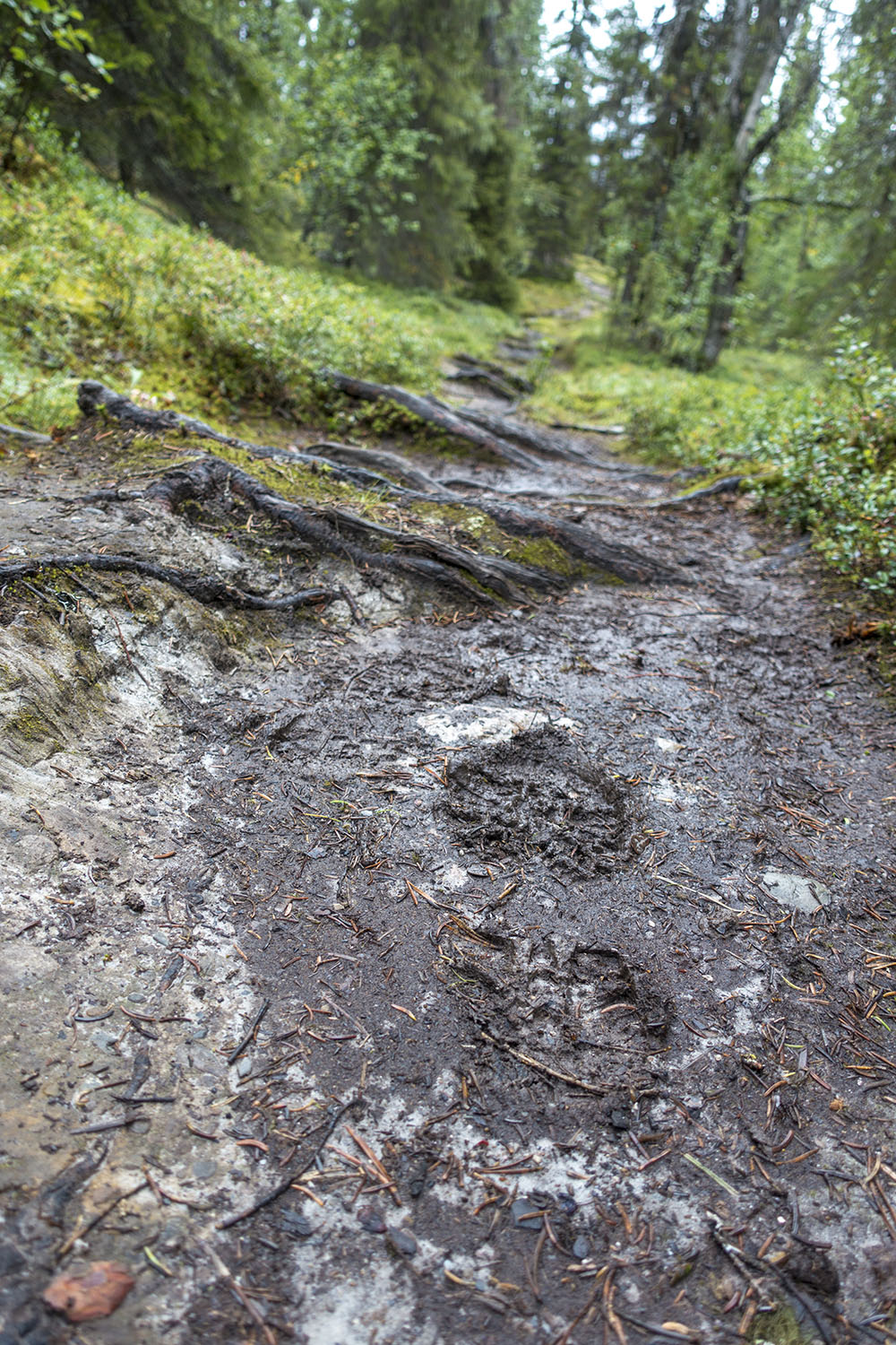
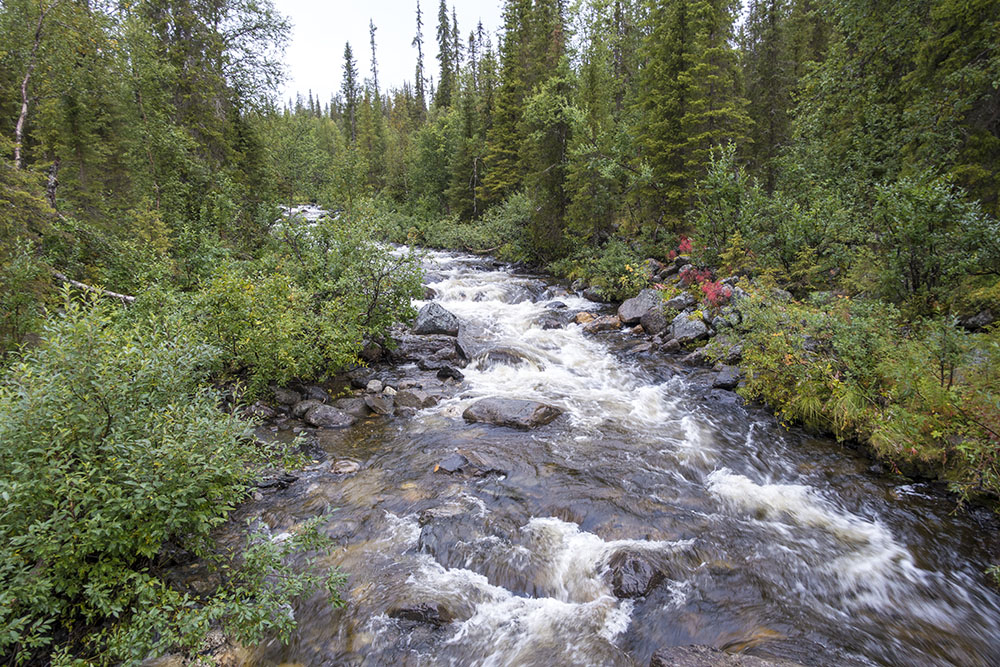
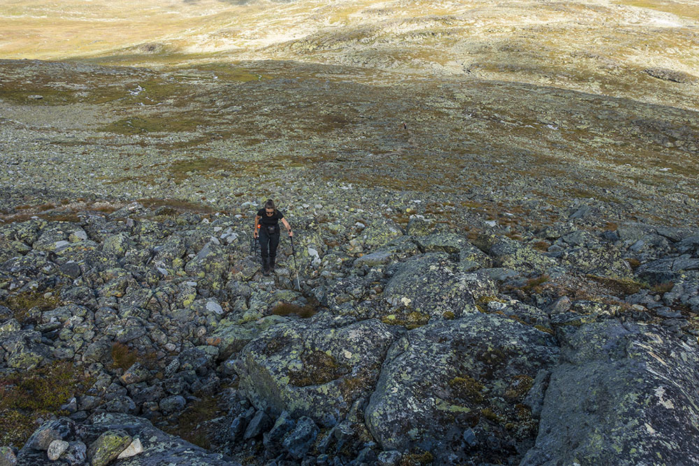
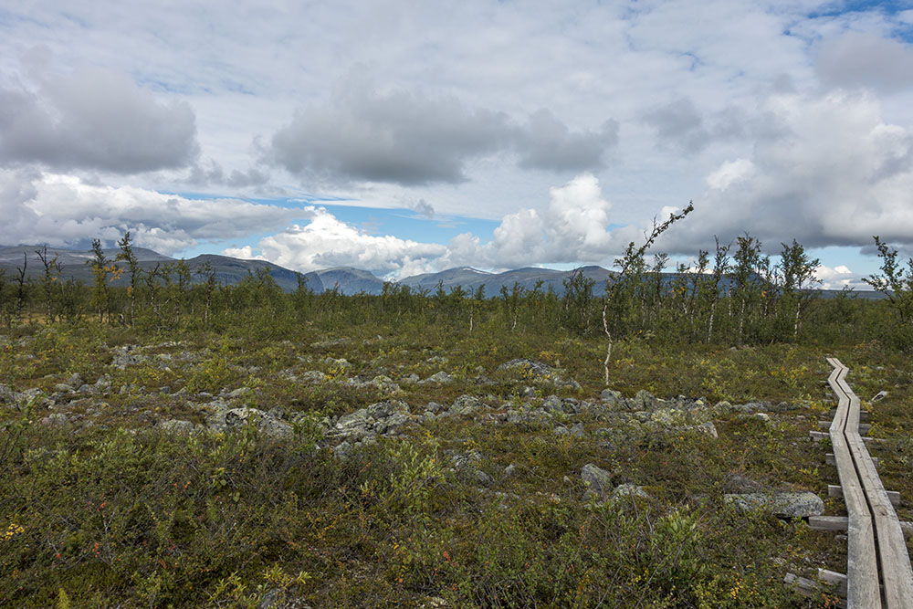
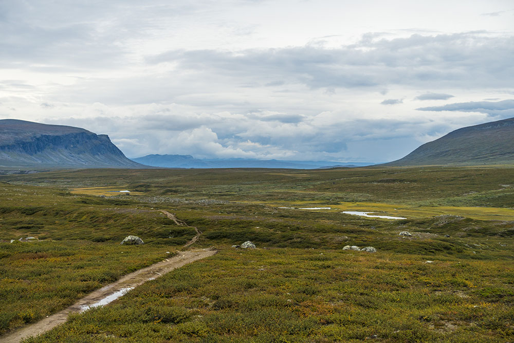
The trail was slowly climbing for the better part of the day, not too steep, but relentless. For the most part it was pretty rough going on a very rocky and wet trail. Hard to get engaged in this section… I don’t know if my expectations had been set too high, but it was kind of uneventful forests and the trail was in really poor condition. On top of that we probably met more people today than we have over the past 3 weeks combined… ugh… takes a little getting used to. I enjoy the solitude!
Once we got to Pårtestugan (STF hut) we asked about suitable campsites further up the trail, but were told it was really scarce. We could either pay for a spot next tot the hut or pay for a bunk inside. It was raining again and we face a pretty long stage in the morning to the boat pickup to Aktse. We had to hike 20 km by 17:15 or we would miss the boat, an 8-10 hour hike according to the host at Pårte. So we would have to be on trail by seven if we were to make it. Knowing our morning routine track record the only way we are going manage this was if we did not have to deal with soaking wet gear in the morning. So we decided to get a bunk for the night, our first on this hike. It rained pretty hard all night, justifying our decision to stay inside. Still, it felt a little bit like cheating…


DAY 2
Pårte – Aktse
Distance: 20 km (+4 km by boat)
Date: 20 August, 2016
STF hut: 67.149570° N, 18.306674° E
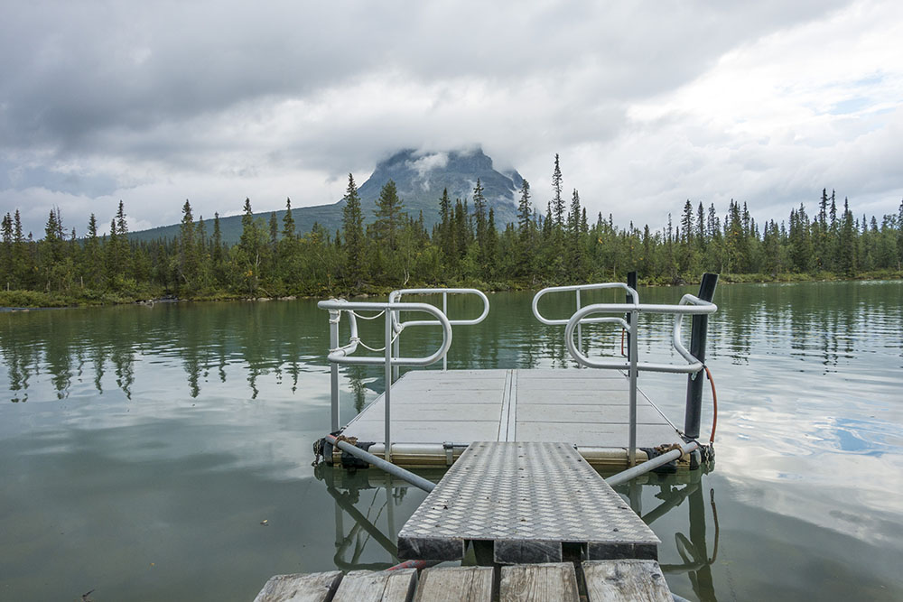
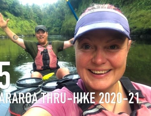
Woke at six. Still dark outside. I had slept pretty well in my bunk listening to the rain outside. We needed to get an early start to Akste in order to catch the afternoon boat. We were shooting for seven, made it by seven thirty. Made good time though and got to the boat landing with about an hour to spare.
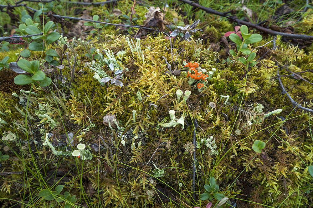
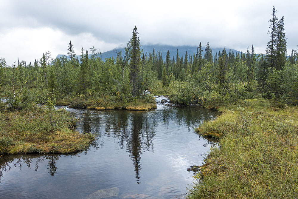
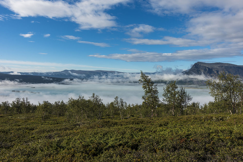
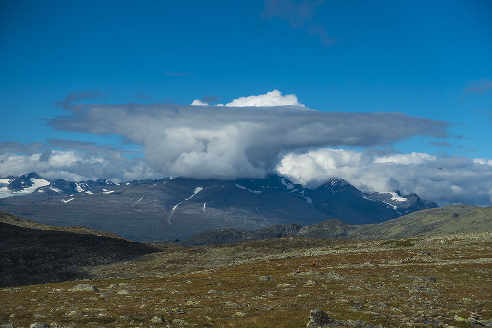
First part of the day was through a pretty dense coniferous forest and a fairly easy hike compared to yesterday, even though it was slowly climbing and was pretty sweaty due to the high humidity. After about an hour or so we crossed into Sarek National park, Kungsleden makes a brief visit here, giving us a taste of what’s to come. The forest here felt very primary and mystical. Once we started climbing in earnest, it was pretty steep, the fog got thicker and it wasn’t long before it started raining again. It came on fast and lasted until lunch. Since it was so hot and humid I had decided to finally put my make-shift rain skirt (read trash bag) to the test. The conclusion… it works ok on the flats, but not so great when you have to climb. It might be good in a pinch but not great for hours of rain, especially not when it is windy. I was pretty soaked by lunch. Rain soaked lower and sweat soaked upper… Oh well. I got to test the concept at least.
Given the weather we were eager to find some form of shelter for a lunch break. As luck would have it there is a small emergency shelter about half way on this stage, perfect! It was empty when we came in, but not five minutes later a whole youth group from Germany started piling in… Six teen boys and a group leader also wanted shelter from the rain and to dry gear. They soon had a fire going in the cast iron fire place and produced two (!) guitars and promptly started singing! A bit surreal. I filmed about a minute of it on my phone. Surrounded by a German boys choir in various states of undress we ate quickly, changed to dry socks (and me into rain pants) and then moved on. We had a boat to catch after all.
The rain eventually stopped and the fog lifted to reveal the valley below as we we began our descent to the boat landing. On the way we met three very curious and unafraid grouse. They did not fly off as they usually do, but walked rather close to the trail watching us and posing for pictures. Interesting!
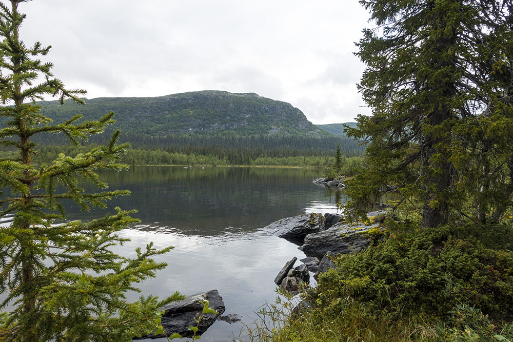
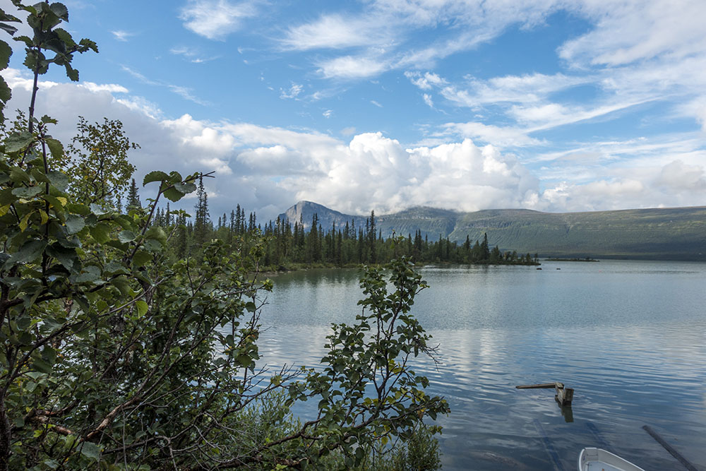
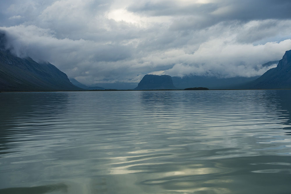
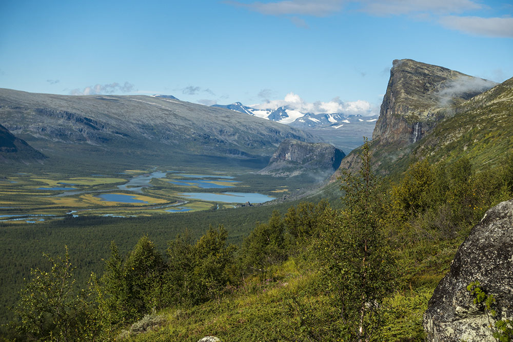
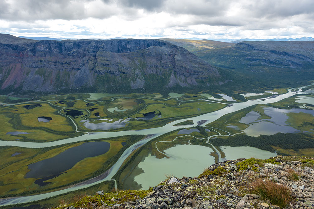
Once down on flat ground again we ran into the Dutch hiker we had met at Pårte the night before. He was sitting on a log making pancakes. Oh, it looked sooo good! We could think of nothing else but pancakes for the next hour… It was only 4 km left to go to the boat landing but it seemed to drag on forever! The ride over was nice though and gave us a fine view into the gate of Sarek and the Rapa Valley. It would probably have been even more stunning on a good day. Still looked very impressive now, almost unreal, veiled in dark clouds and remnants of fog drifting through.
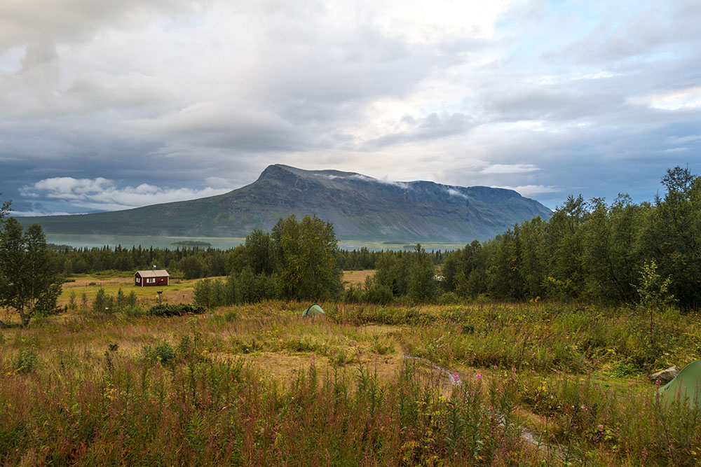
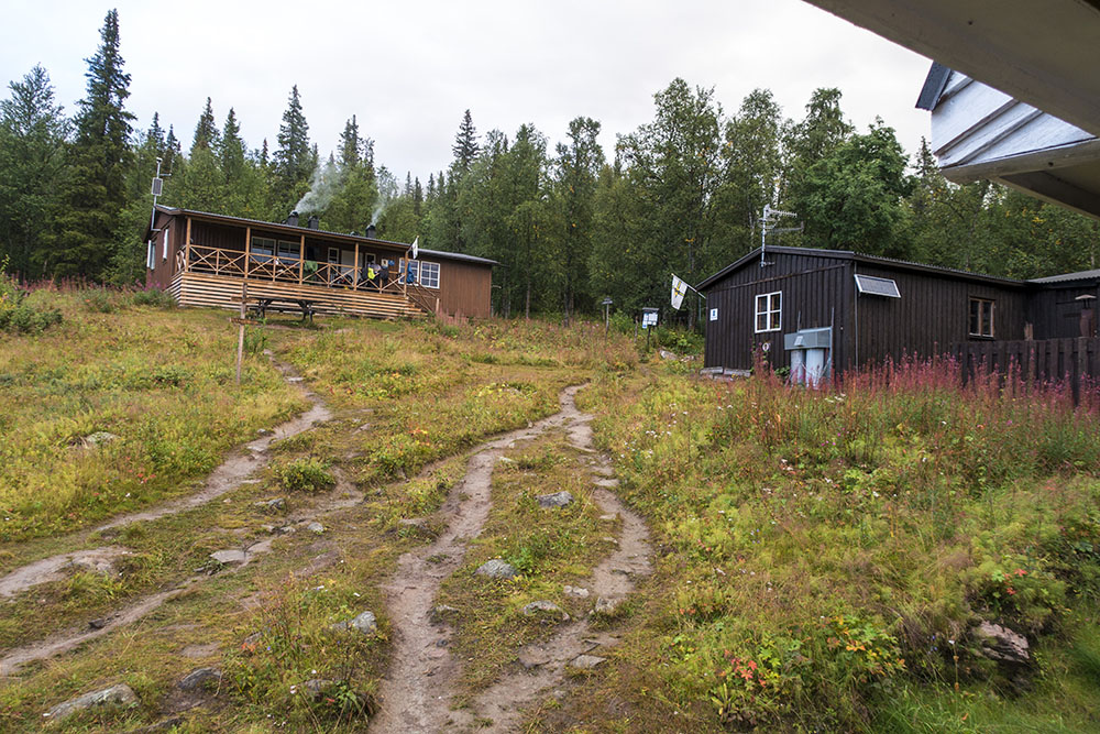
Aktse is a bit larger than Pårte. Several huts and even a small store. Lots more people too. It is a pretty popular since it is located so close to Sarek. It was raining again when we pulled in, so we decided to check in and stay for the night. We have nothing to prove. Glad we did, the rain kept on going pretty hard all night. Spent the evening eating, talking, sharing a wee but of whiskey (Laphroaig) with the dutchman and a couple of German hikers before bedtime. Unfortunately some of the younger hikers had a lot of wet gear and kept feeding the fire in our room all night, turning it into a sauna. Hard to sleep when it is this hot! Does not help that at least 3 out of the 8 people in here are snoring really bad too. I have my earplugs in, and it is still nearly impossible to sleep… missing my tent right about now.


German boys choir…
DAY 3
Aktse – Mártevárásj
Distance: 19 km
Date: 21 August, 2016
Camped: 67.149570° N, 18.306674° E
Hardly slept at all last night on account of all the snoring! Had earplugs in, but still it felt like I was sleeping in a saw mill. Finally morning came.
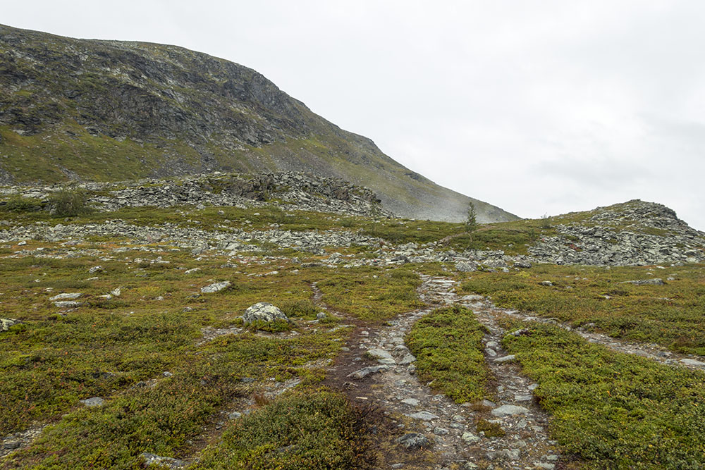
We got up early as we wanted to beat the crowds heading up Skierfe, a 15 km detour from Kungsleden and a very popular scenic summit ascent. We hit the trail by eight. The first part out of Aktse is a pretty gruelling climb. I don’t mind climbing, but I hate climbing right after breakfast. I am no morning person and I also have pretty slow metabolism so I don’t feel like the food has converted into energy yet. So it is all a mind game for me before my body catches up, then I am fine. We met a hiker coming down the trail though who actually recognized me from Instagram and greeted me by name. Interesting. Not too many purple haired hikers I guess… a small world.
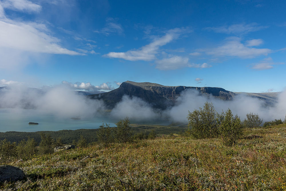
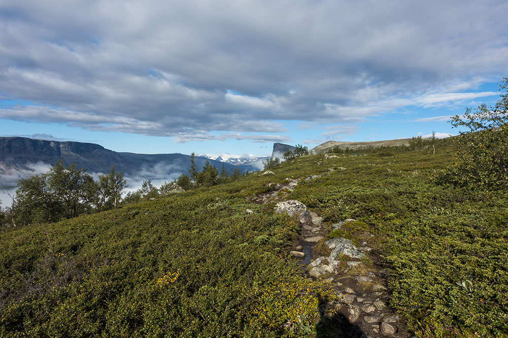
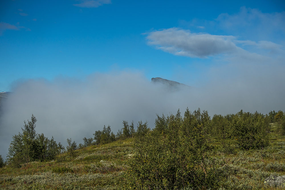
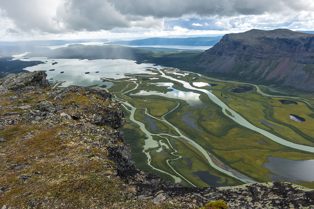
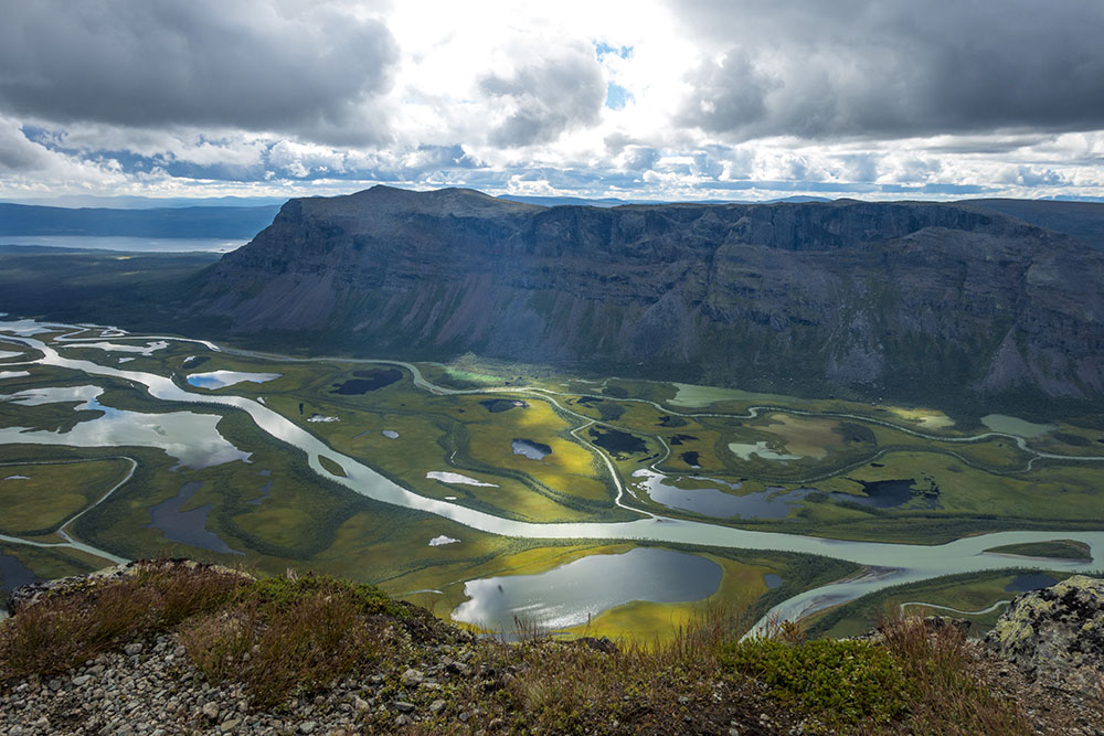
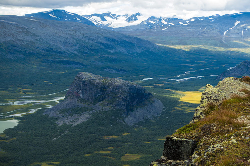
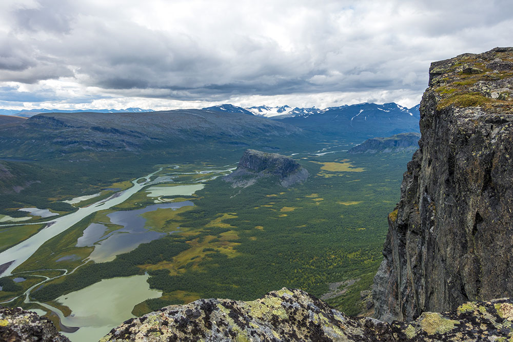
Once up the mountain we turned left towards Skierfe. The morning fog had been a thick as a blanket down in the valley, but up here it already was starting to dissipate. A little bit at a time it slowly revealed the iconic profile of Skierfe and colorful Rapa Valley in the distance, a little bit by bit, almost like unwrapping a present… a bit mystical.
It was actually shaping up to be a gorgeous day! We are so lucky considering the weather for the past two days, perfect for a summit ascent. We dropped our heavy backpacks a little ways off the trail and packed water and a lunch in the top lids of our backpacks using them as day packs before moving on. It took a little getting used to hiking without the heavy weight on our backs, but it would be nice to travel fast and light for the day.
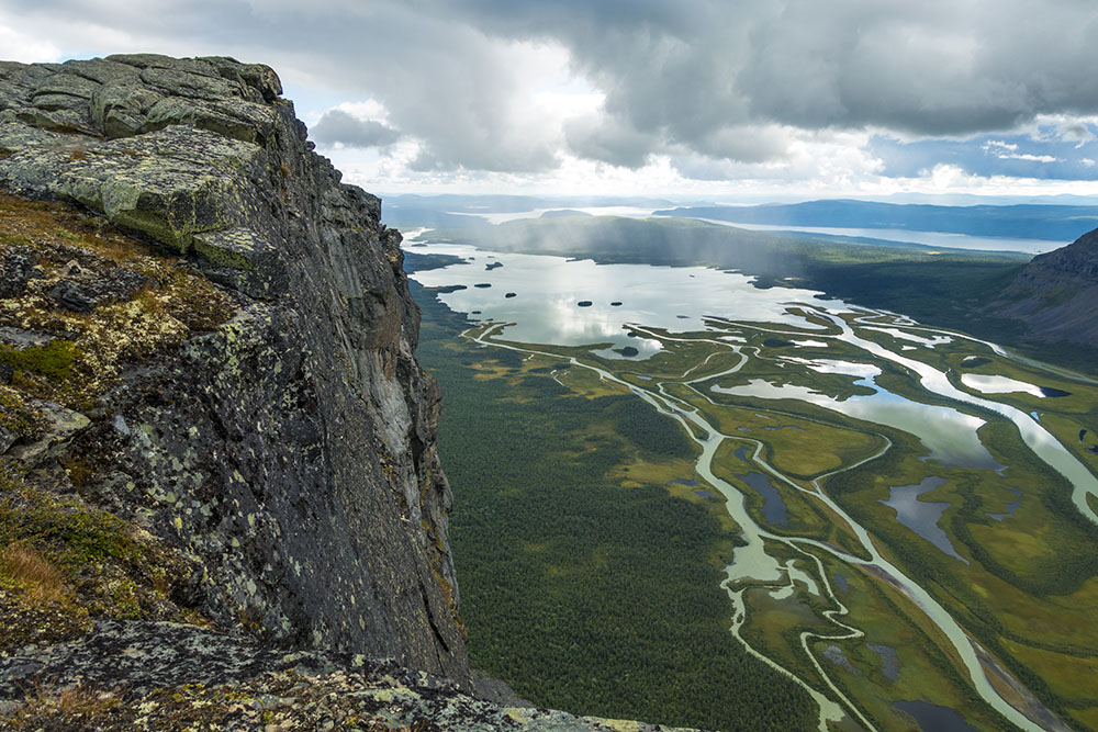
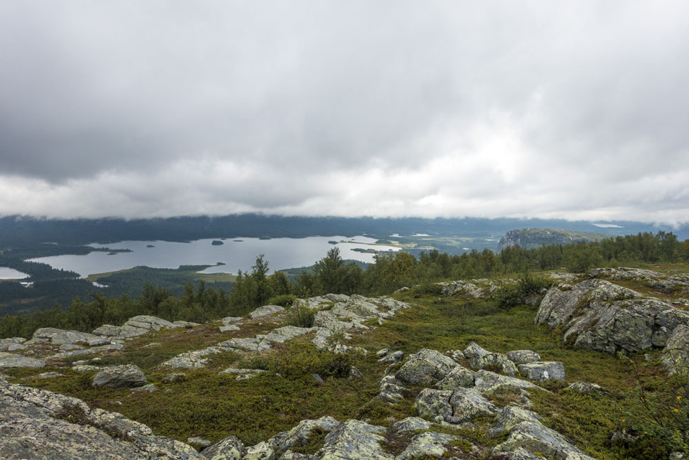
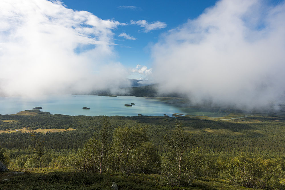
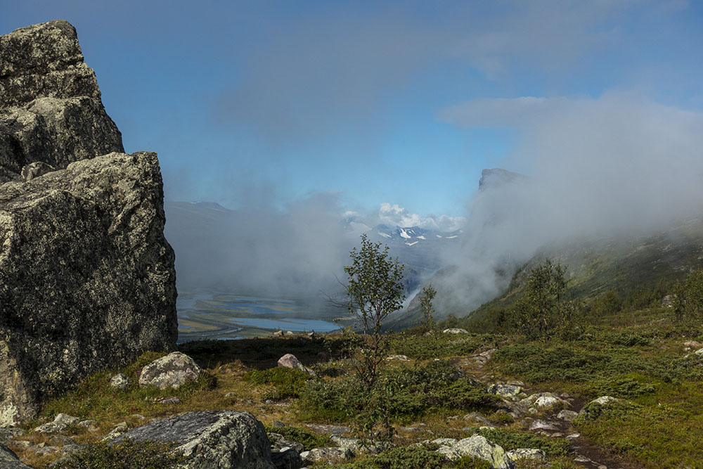
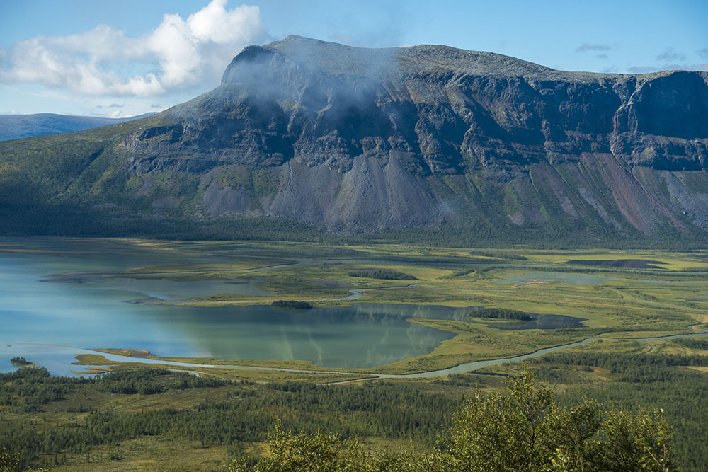
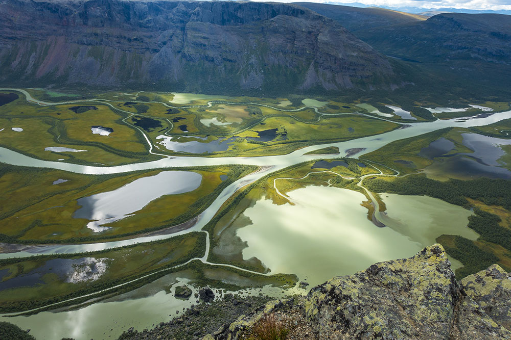
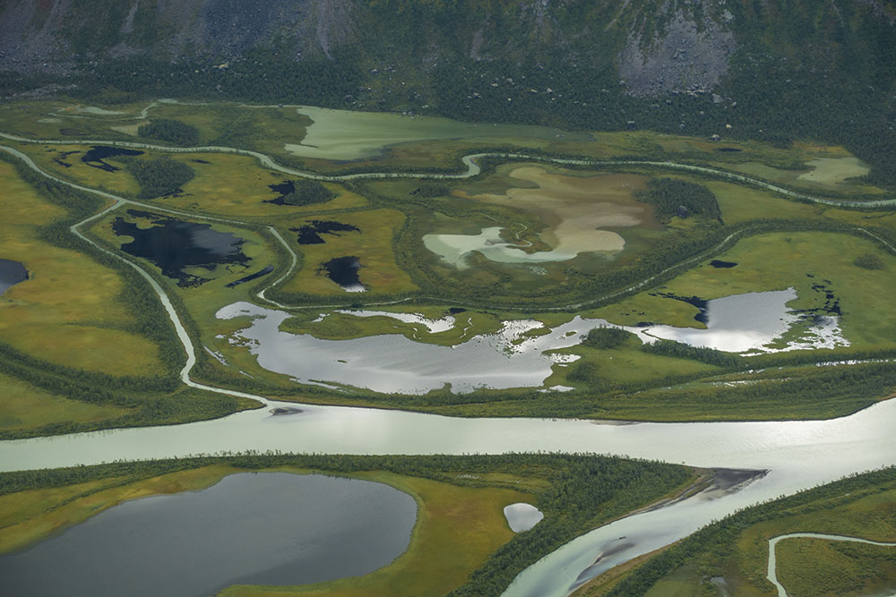
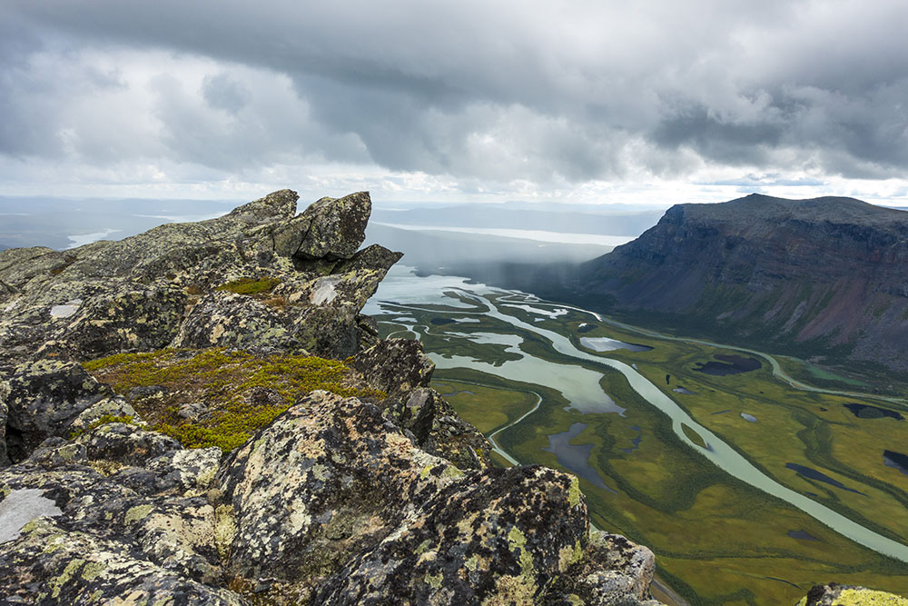
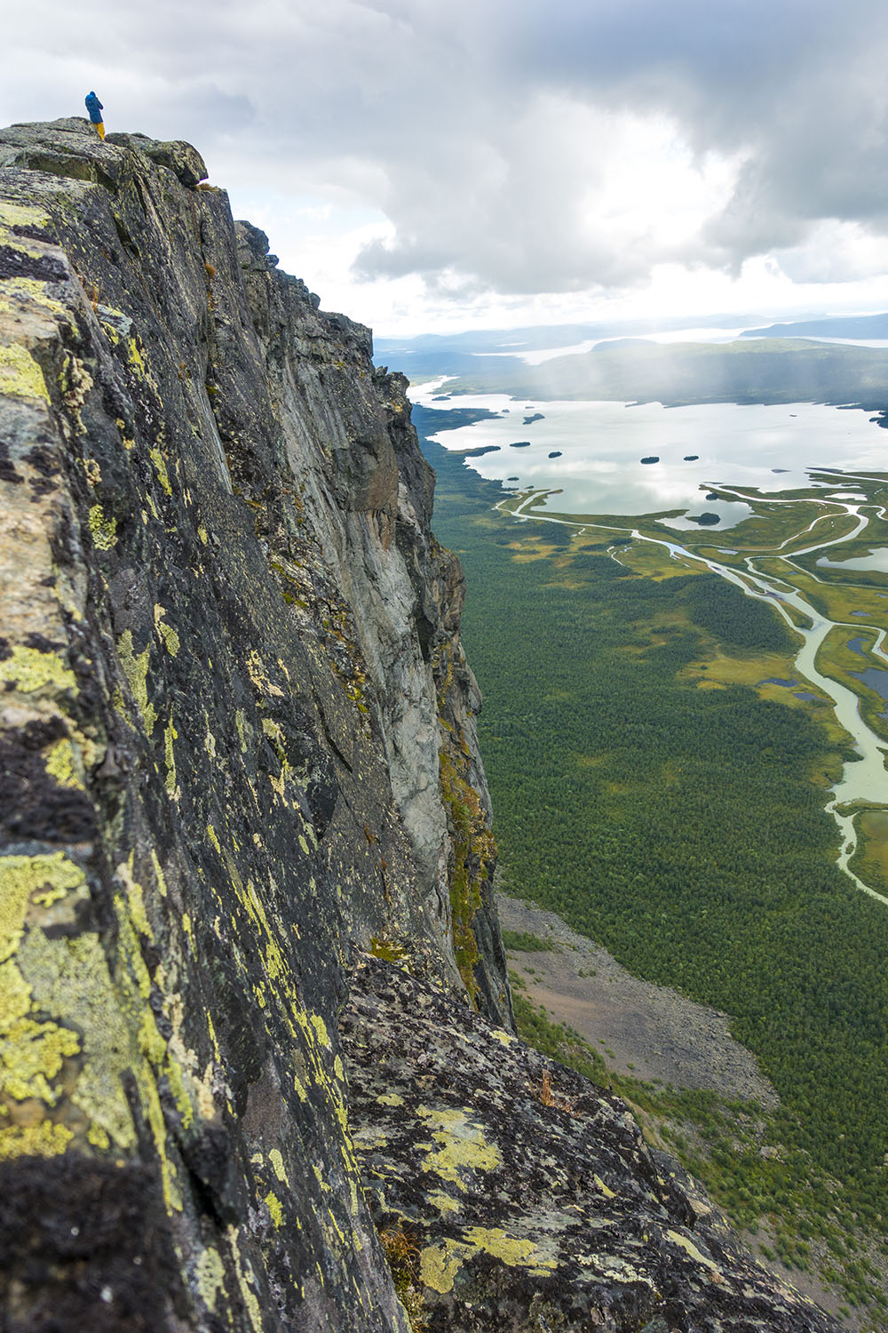
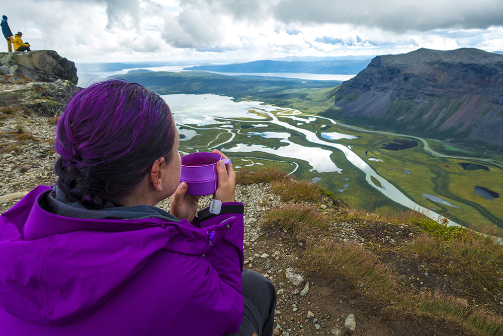
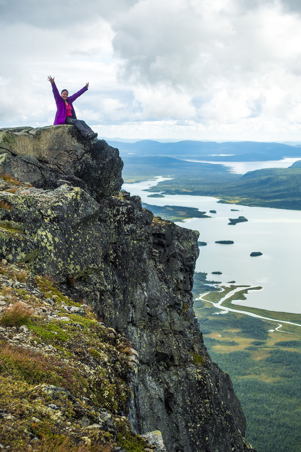
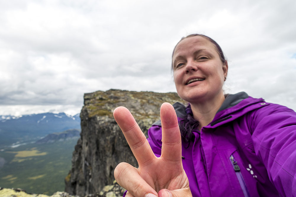
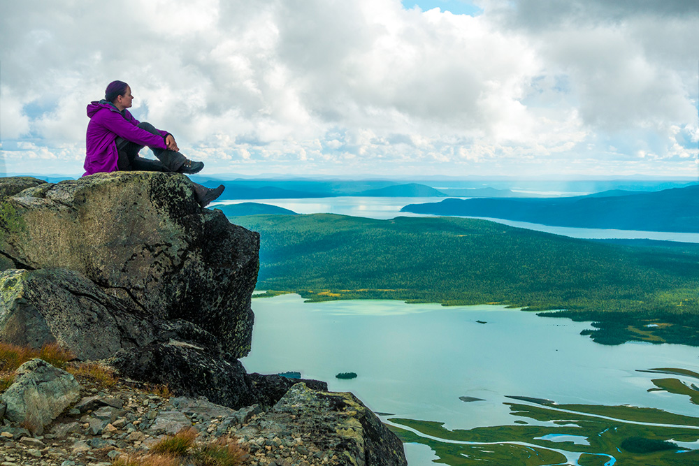
The experience on Skierfe was truly amazing! The cliff formation is pretty special with a steep 90 degree drop-off, but what makes it so unique is really the location facing the stunning valley below. You could not construct nicer bleachers for the Rapa Valley delta if you tried. The ascent to the summit was pretty steep and rocky, felt almost volcanic in nature, but was not too difficult to manage. We made pretty good time so we almost had the summit to ourselves, save for three other hikers. Nice! By the time we left it started getting crowded up there… but before then we had time for lunch and did some photo sessions. The views were unreal! While I was sitting on the very edge dangling my legs, fighting vertigo and posing for a photo, a golden eagle flew by just a few meters below my feet! Amazing! I feel so lucky! It was also incredible to finally get to see the Rapa Valley delta in real life! I have seen so many photos, but they cannot capture the grandeur of it all. You really have to be there!
Almost a surreal feeling to actually be here, and the feeling lasted for a good while on the way back too. I felt almost drained, like all synopses in the brain had fired all at once like fireworks, leaving me completely spent. Brain does not work too good now, but I am happy anyway. Changed me for life I think.
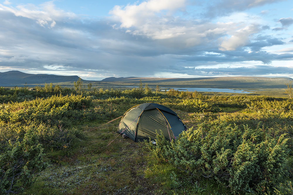
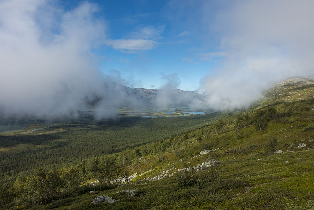
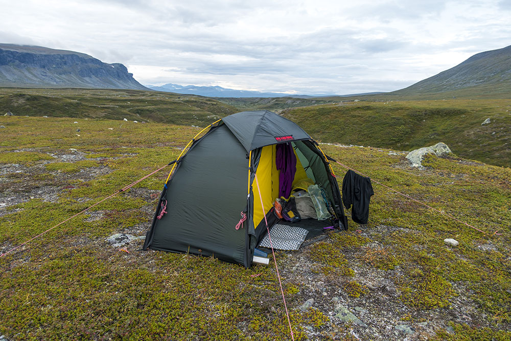
We had no plans on returning down to Aktse. Instead we wanted to find a place along Kungsleden to put up camp for the night. But we ended up having to hike across the entire mountain before finding water. It was completely dry everywhere! So even though we were tired we had to push on. Cannot make camp with only a few deciliter of water left… We ended up doing about 19 km today, including a summit ascent, yeah baby! Hard core! We finally found a beautiful tent spot though. We are on the eastern slope so I am looking forward to the sunrise here. Will decide what to do about the next stage in the morning. We could make Saltoloukta a day early or take our time getting there. Worth seeping on it before deciding.
While eating dinner we actually got some company! This is unusual. We have not had company at our wild campsites yet on this hike. We had already tucked in for the night, but hopefully we will get a chance to say hello in the morning. Too tired to read… no sleep last night and a very, very long day today… nite nite!


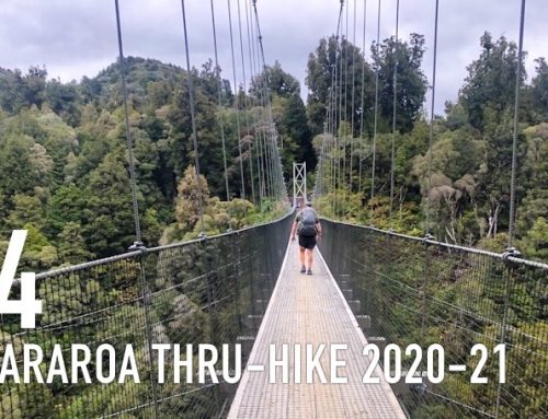
DAY 4
Mártevárásj – Áhusjavágge
Distance: 12 km (4 km by boat/rowing)
Date: 22 August, 2016
Camped: 67.149570° N, 18.306674° E
Sleept in this morning since we put in the extra kilometers yesterday. It was nice to take it a little easy because it was a gorgeous morning. Clear blue skies and sunny. We have not been spoiled with these kind of mornings, so I was soaking it all in.
Turns out our neighbor, a nice Lule-girl named Hanna, is another Gröna Bandet hiker walking southbound. We ended up talking for quite a while and didn’t get on trail before 11:30. This kind of encounter is worth the time though. Nice to share stories with a likeminded hiker. We actually haven’t met too many… Hanna lives in Gothenburg at the moment (when not hiking) so we decided to meet up and share stories when she gets back sometime in October. We gave her our contact info and wished her luck.
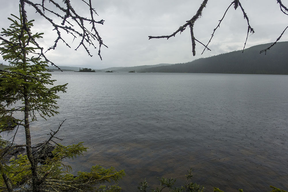
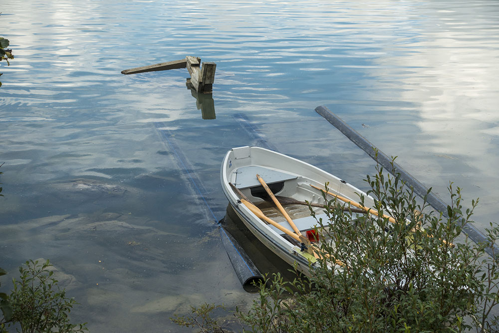
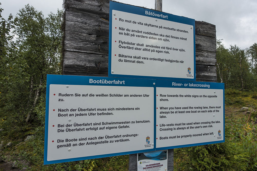
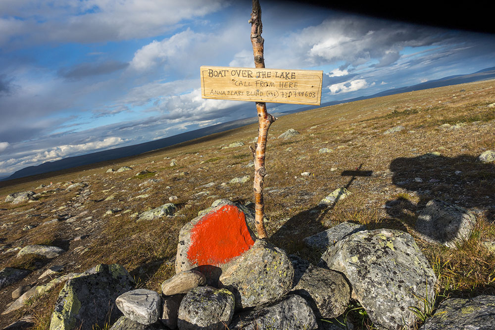
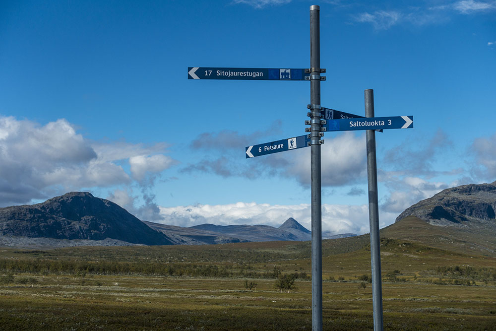
We walked the short distance to the boat landing over to Sitojaurestugorna, the huts we had originally intended as our stage goal today. We decided to row across this one and shared the boat with a nice German couple. The guy would not accept our offers to row however and ended up doing the entire distance for all of us. Very nice, but pretty hard… We had to navigate shallow banks and big rocks sticking up all over the lake by following a marked path between buoys and sticks. Currents were also strong at times and I think they intentionally make the boats kind of crappy and hard to row so you will opt to pay for the crossings instead. Took about 80 minutes to row, and of course it started raining…
Since it was raining again we ducked in to the hut to make our lunch and get out of the wet for a while. Finally the rain let up and around four we were back on trail. We decided to take our time up to Saltoloukta. So we just walked another 8 km and found a very nice camp spot on the edge of a ravine. Gorgeous views!! As I am laying here writing the rain started again though. Oh please, oh please, oh please let the weather stabilize before we go into Sarek!


DAY 5
Áhusjavágge – Saltoloukta
Distance: 12 km
Date: 23 August 2016
Mountain Station: 67.394401° N, 18.521356° E
Woke around four to crazy winds and pouring rain. Sighed, turned over and fell back asleep. When it was time to get up the rain had stopped at least, but wind were still rocking the tent like crazy! Nice to have a bomb proof tent, it stayed put. My friend lost a tent spike though.
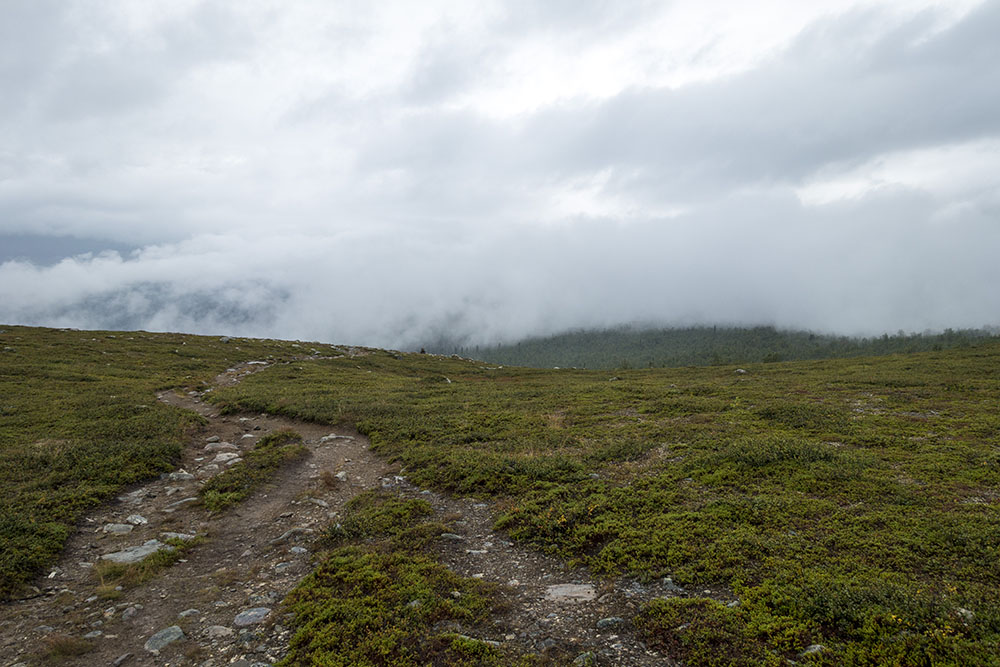
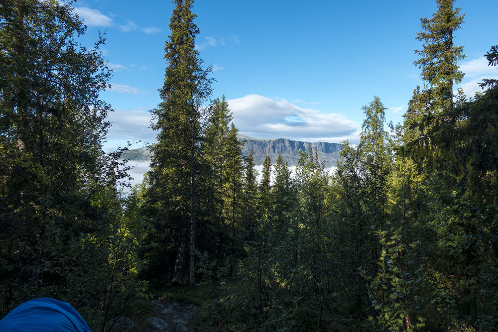
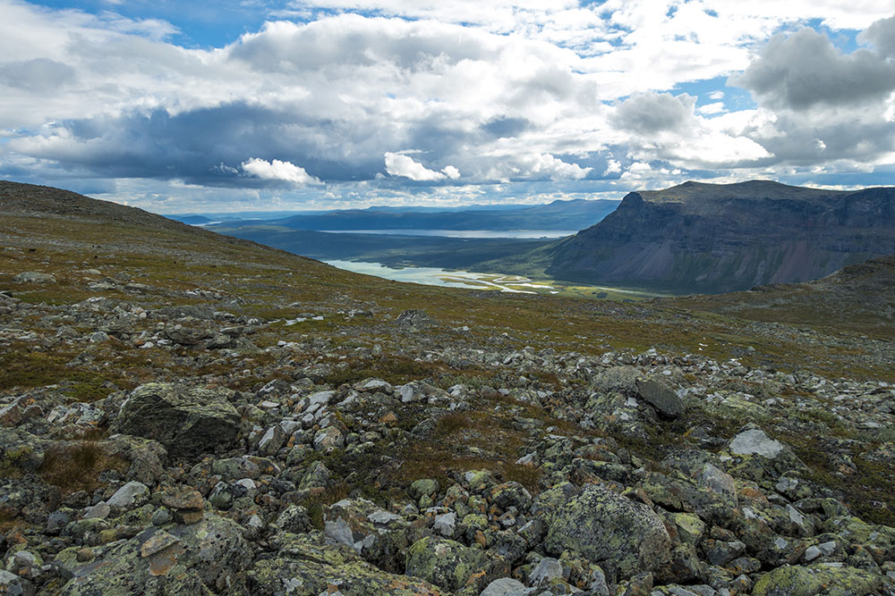
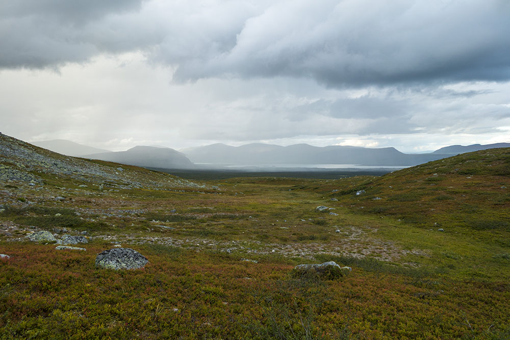
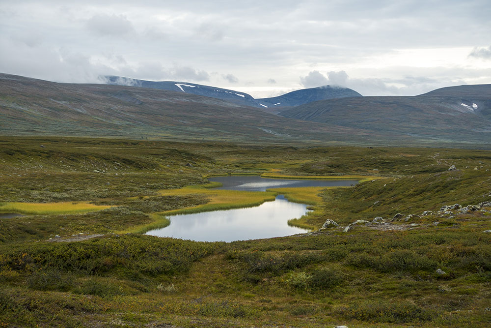
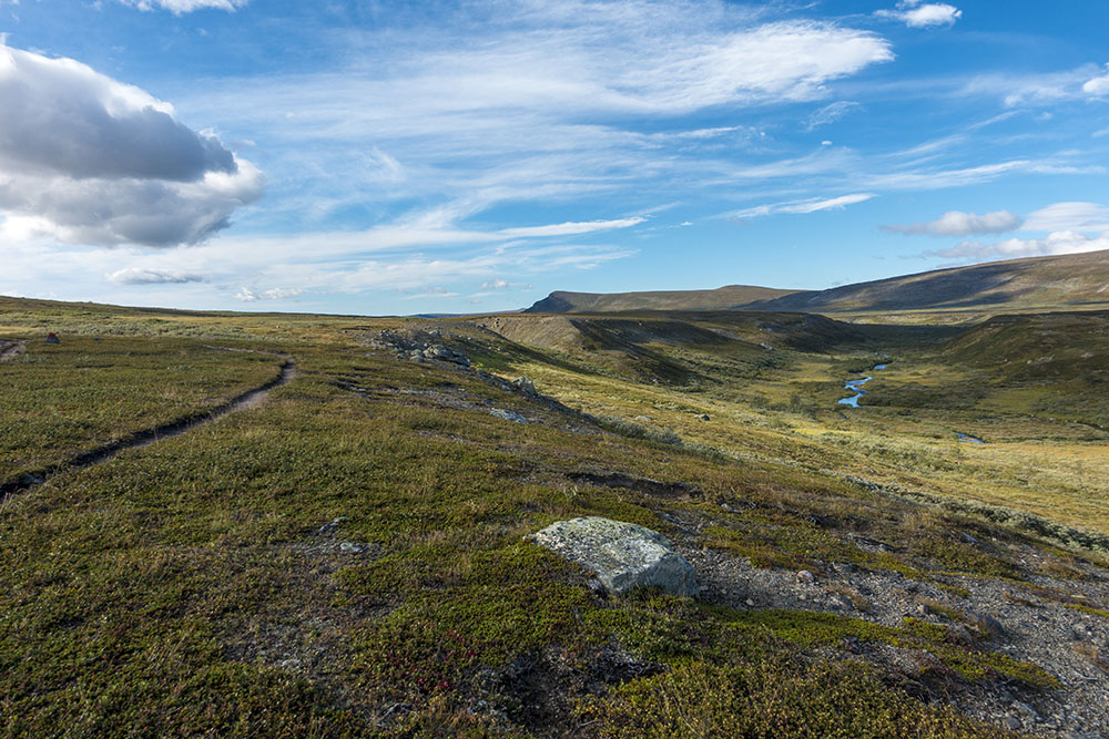
The last few kilometers of stage 4 was pretty uneventful. We exited the long valley we had been walking through for the better part of the day yesterday and actually got a glimpse into Sarek and of what’s to come… there were white caps on the lake in the valley leading into the wild. We stopped to look in silence. Mostly with feelings of anticipation and excitement, but also with a healthy dose of respect. It will be a challenge for sure!
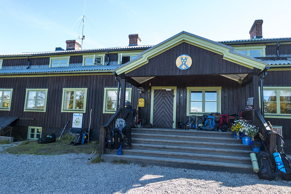
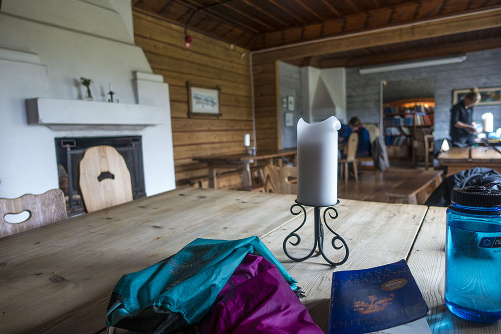
Saltoluokta mountain station is beautifully located by a large lake and with spectacular views. We walked in at around three and got a nice dorm room in one of the older buildings. Got it all to ourselves for the first night, then got two French guys as roommates the second night. The reputation of the 3-course dinners here are all the buzz on the trail, so we splurged the first evening and did that, then made our own food the next. Will splurge on a nice breakfast too before we leave though. Lively place! No televisions and lots of old charm and wood burning fireplaces and candles instead of electric devices for the most part. Very nice!
We are taking another proper rest day here, so two nights, although the term rest day may be taken with a grain of salt. Rest days are actually quite filled with chores. But that will have to wait until tomorrow!


Windy morning … tent life.

DAY 6
Rest day – Saltoloukta
Distance: 0 km
Date: 24 August 2016
Mountain Station: 67.394401° N, 18.521356° E
Rest day chores… shower, laundry (by hand this time – no washer to rent), boot care, sort and repack supplies, foot care, body care… yeah everything needs a little extra care these days… Still time for some reading and social media updates and just relaxing too. We also had some planning to do for our Sarek adventure, so we poured over the map and notes making a general plan for the stage.
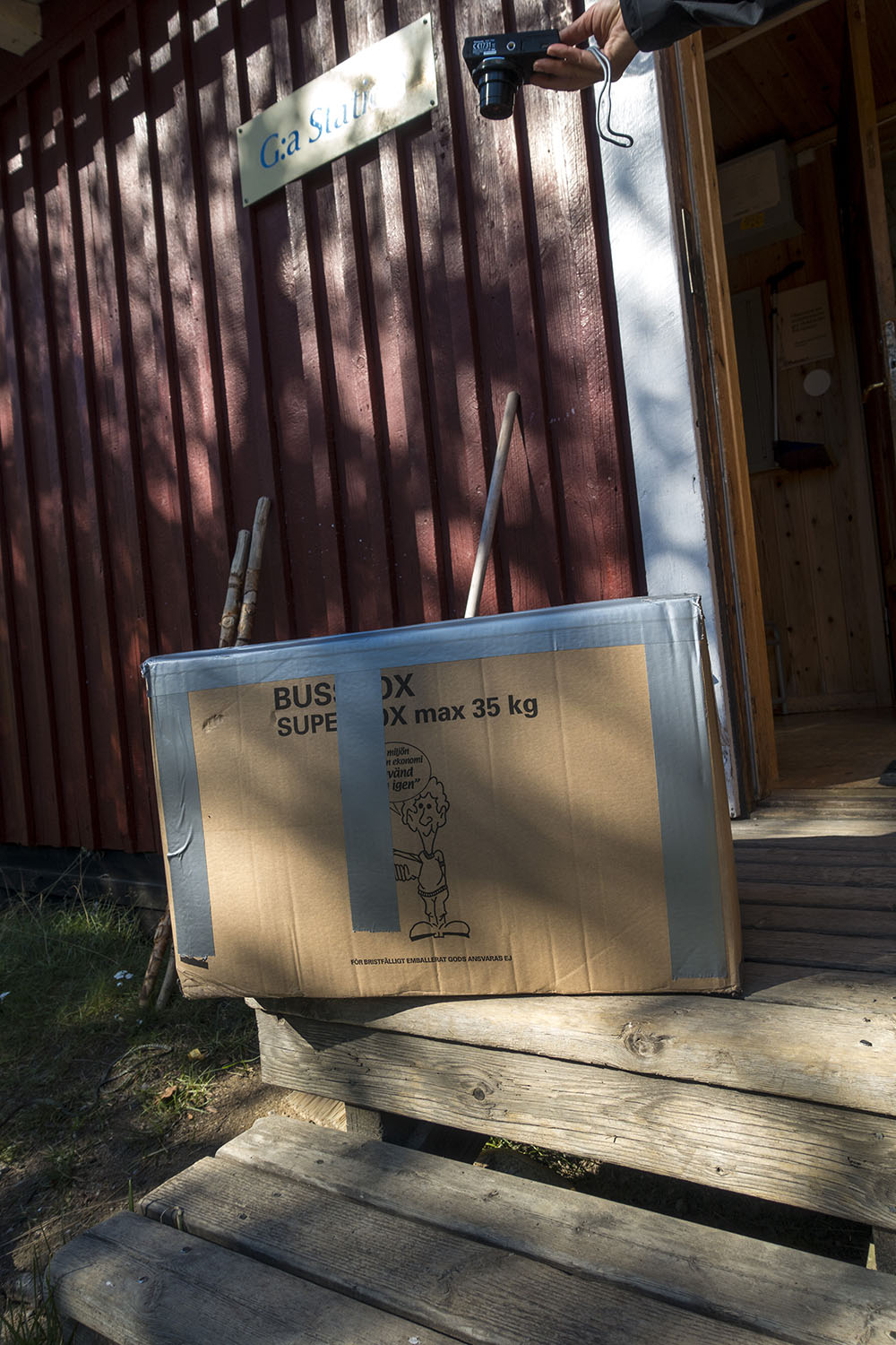
I also had a special package waiting for me – my new tent! Thanks Hilleberg! I sent the Soulo home. A little weird, but I will kind of miss it… I set up the Allak on the lawn outside our room just to make sure it was all there and also to attach the footprint underneath. It is very nice, but HUGE!!! How will I ever fit this and 9 days of food in my pack? Oh well, I am committed now. I just need to work out a new packing system for the backpack that’s all…
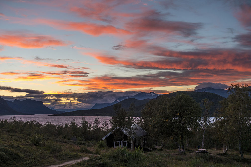
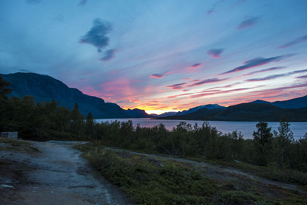
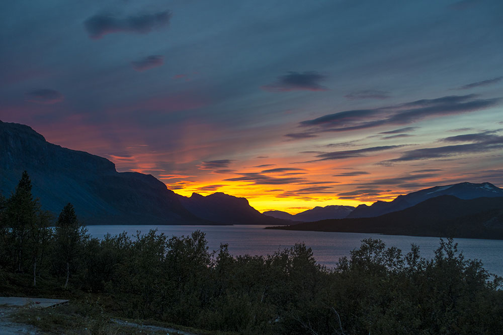
My knees are a little stiff but are still holding up. No pain, and for that I am eternally grateful! We had an amazing sunset tonight! One of the most beautiful ones I have ever seen. There were a lot of us standing out watching it, and taking photos, for quite some time in silence.
Tomorrow we set off towards Sarek! Exciting!

Leave A Comment