There is a range of different tools and techniques you can use to navigate your way safely from A to B. Through years of trial and error we have found a way that best suits us, our gear, and fulfills all our needs.
Gear
iPhone 8 (x2)
- weight: 148 g
- storage: 64 GB
- very fancy camera: 12 MP/ up to 4K video
Lifeproof Fre cases (x2)
- waterproof, dirt proof, snow proof, drop proof… yeah expedition proof
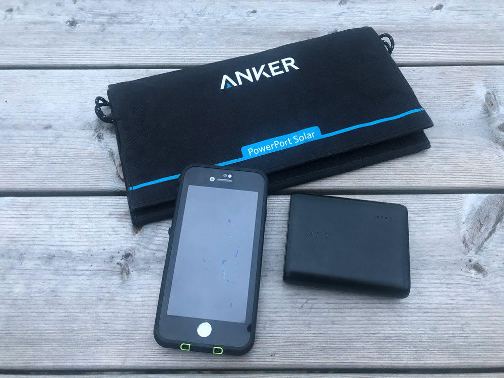
Anker 15W powerport solar lite panel (x1)
- weight: 350 g
- charging speed: up to 2.1 amps (direct sunlight)
- portability 28×16 cm
Anker powercore 13000 powerbank battery (x1)
- weight: 255 g
- 2 USB charging ports
- 4-5 phone charges per charge
Gaia GPS app for iPhone (membership: 568 sek/ 91 nzd = 5 years)
- download offline maps
- extensive worldwide maps
- many choices of topo, satellite, and road maps
We chose to use the Gaia GPS app. The basic membership gives us multiple topo map options. It allows us to upload GPX tracks, plan trips and record GPS tracks offline, browse hiking trail maps and more.
The ability to have two iPhones with GPS and be able to charge and store power on the go is great. The Anker solar panel is light-weight and easy to strap on to the backpack for all day charging while we walk. We store the charge in the powerbank battery so we can charge our phones and devices (headlamps etc) at night when we stop. It also gives us some peace of mind for those days with limited sunlight.
Knowing we are self-sufficient with power off-grid is a fantastic feeling! A lot of the worry around relying on a GPS system is gone, especially since we have two devices, in waterproof and shock protected cases, at all times.
Leave A Comment